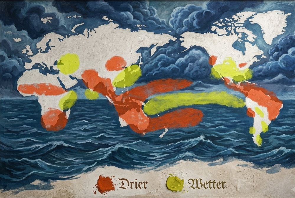
Thousands of kilometres from any African farm, a patch of the Pacific Ocean near the equator has been heating up since the middle of the year. It now sits more than 2°C above normal. That warm water is the engine of El Niño, and this one is shaping up to be among the strongest on record.
In September, the World Meteorological Organization said there was an almost certain chance that El Niño would last until at least February 2027, and that it could be one of the strongest since 1950. In October, the US weather agency's Climate Prediction Center put the odds of a strong or very strong event through early 2027 at more than 83%.
El Niño does not bring the same weather everywhere. It moves rainfall around the planet. India and Australia often turn dry. Parts of South America flood. Across Africa, the World Bank's latest Africa Economic Update expects two very different seasons on one continent: too much water in the east and too little in the south.
Why this matters more in Africa than almost anywhere
Most African farmers still farm with the sky. According to FAO, less than 4% of cultivated land in Sub-Saharan Africa is equipped for irrigation. In Southern Asia, it is 46%.
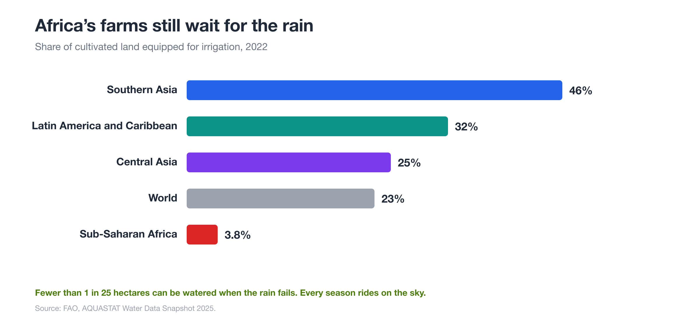
The World Bank estimates that more than 60% of people in the region depend on small farms. When the rain comes late, too hard or not at all, there is no backup tap. The report expects the biggest effects on food to arrive in 2027, after the harvests that are being planted now.
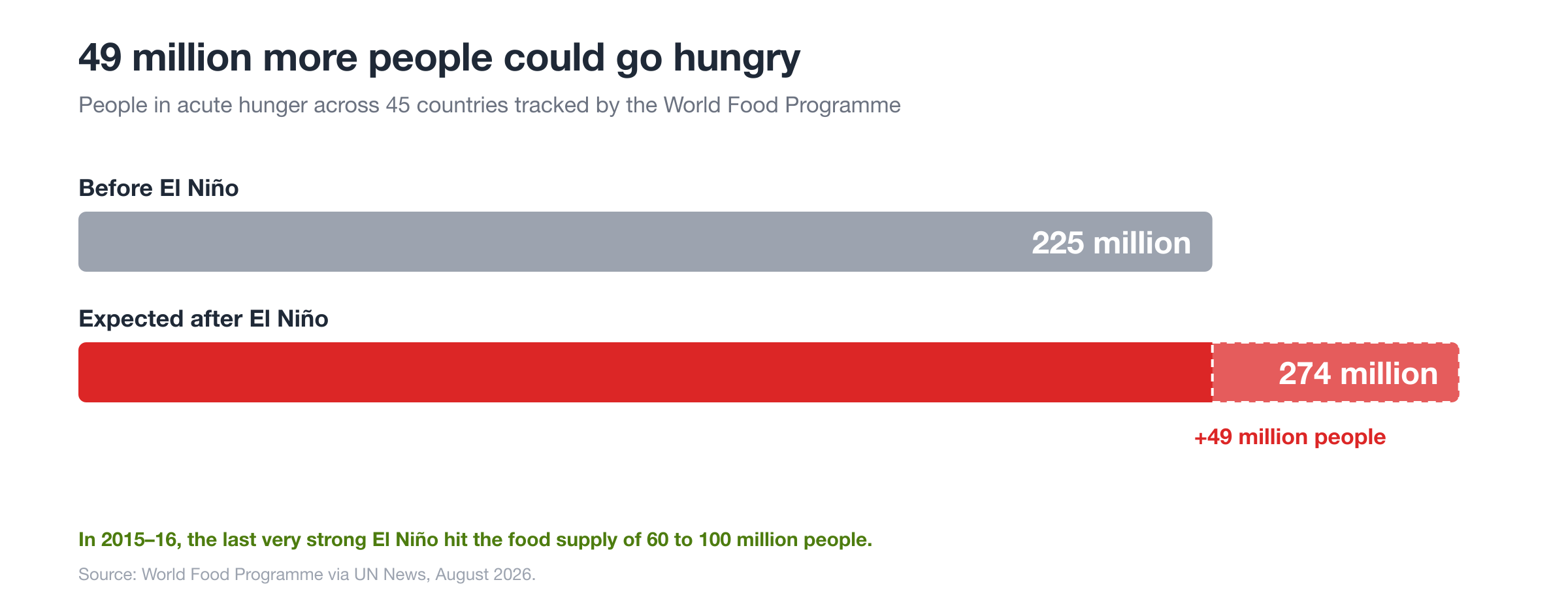
The World Food Programme has done the arithmetic. Across the 45 countries it tracks, it expects the number of people in acute hunger to rise from 225 million to 274 million because of this El Niño.
East Africa: the rain has already arrived
For Kenya, El Niño usually means a wetter short rains season. In August, the Kenya Meteorological Department forecast above-average rain over about 80% of the country for October to December, with Nairobi, Kiambu, Nakuru, Kakamega, Kisumu, Mombasa and Garissa among the counties expected to be wettest. The World Bank also flags the Lake Victoria basin, central Ethiopia and southern Somalia as flood risks.
Kenya knows what this can look like. The 2023 short rains were boosted by a weaker El Niño than this one, and the floods that followed were severe.
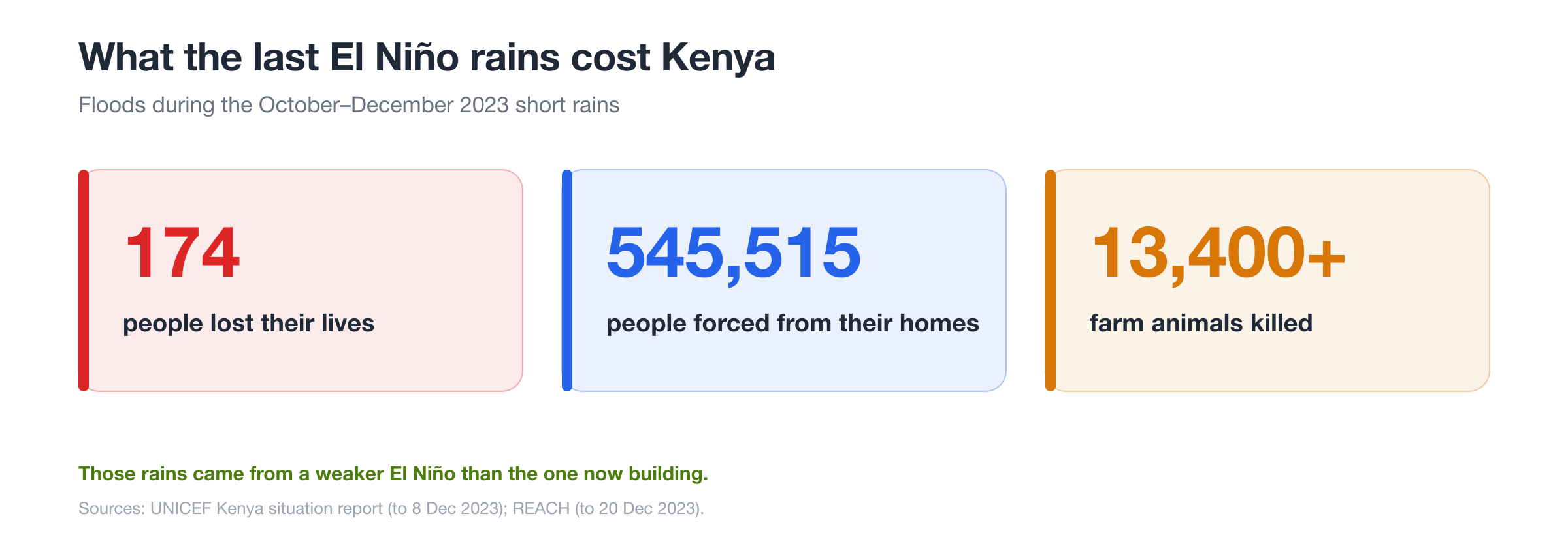
According to UNICEF, more than half a million people had to leave their homes by early December that year. Roads washed away, which cut farmers off from buyers just as crops were ready.
Heavy rain is not only bad news. In the dry north and east, it can refill pans and dams, bring back pasture and give herders a strong season. The difference between a good season and a lost one often comes down to how well a farm is prepared before the water arrives.
Southern Africa: drought at planting time
The outlook in the south is the opposite. From Zambia and Zimbabwe to Malawi, Mozambique and South Africa, El Niño tends to bring hot, dry weather between November and March, when maize is planted and grows.
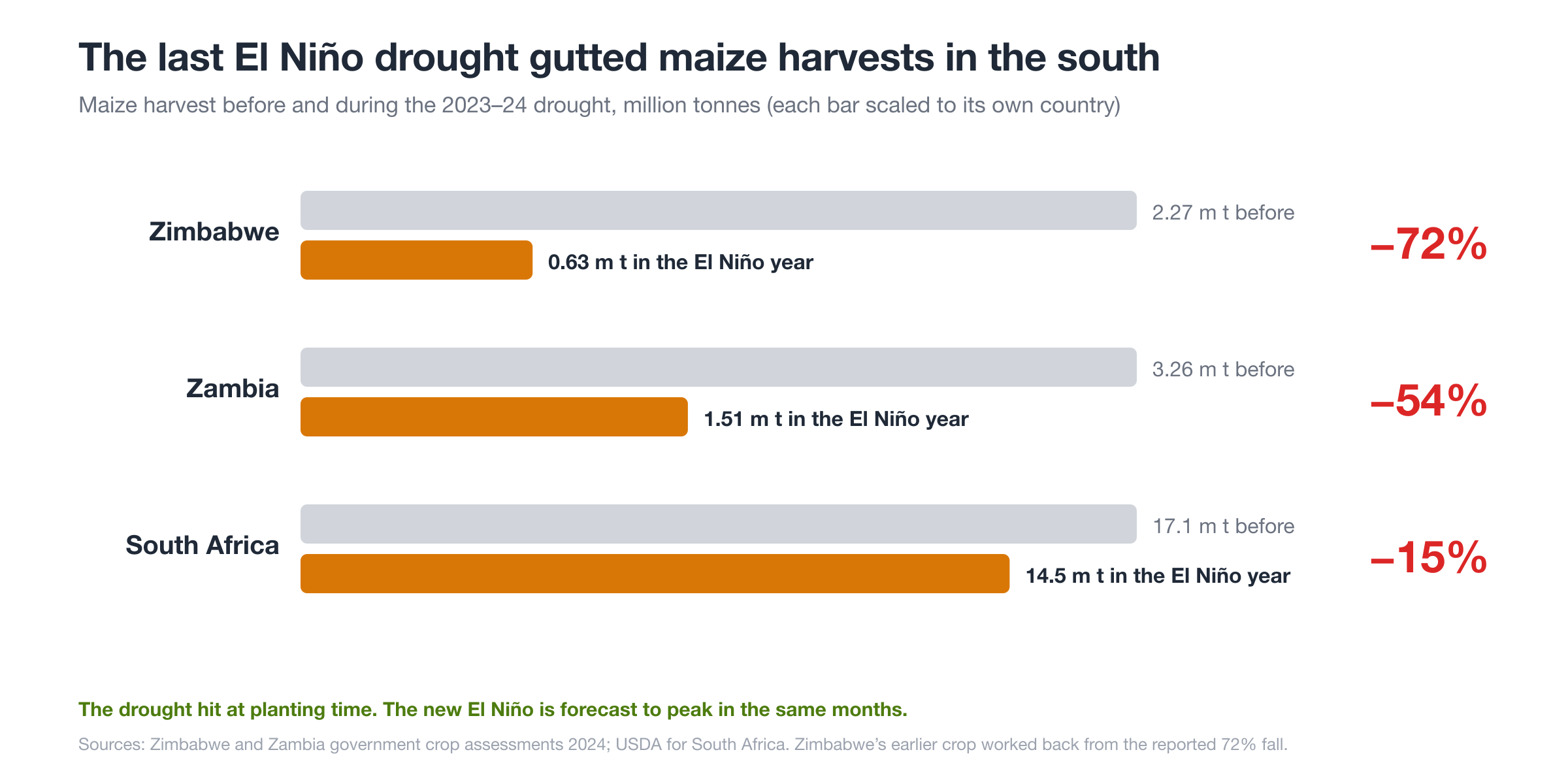
The region has lived through this very recently. In the 2023–24 season, the last El Niño brought the worst drought in decades. Zimbabwe's maize crop fell by 72%. Zambia's fell by more than half, and about 9 million Zambians were affected.
This matters to Kenyan farmers and traders too. When the south runs short, it buys grain from the rest of the region. In 2024, Zambia arranged to import 650,000 tonnes of white maize from Tanzania. Strong demand from the south can push up maize prices across East Africa, which is good for farmers with grain to sell and harder on families who buy it.
Animals and disease
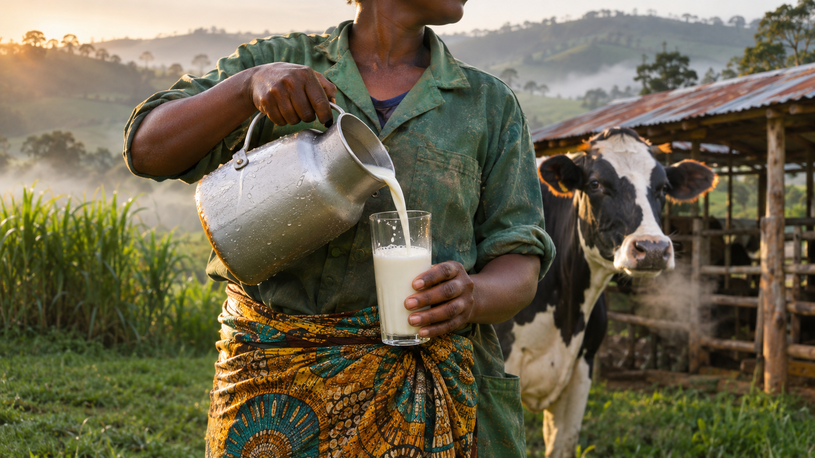
Livestock face their own risks in a wet year. Standing water breeds mosquitoes, and mosquitoes spread Rift Valley fever, a disease that kills young animals, causes abortions in cattle, sheep, goats and camels, and can infect people. The World Health Organization links outbreaks in East Africa closely to El Niño rains. The large outbreak in Kenya, Somalia and Tanzania in 1997–98 followed exactly this kind of season.
Foot rot, liver fluke and tick-borne diseases also tend to rise when pastures stay wet for weeks.
What farmers can do now
Forecasts are a gift if they are used early. Here are practical steps for the weeks ahead:
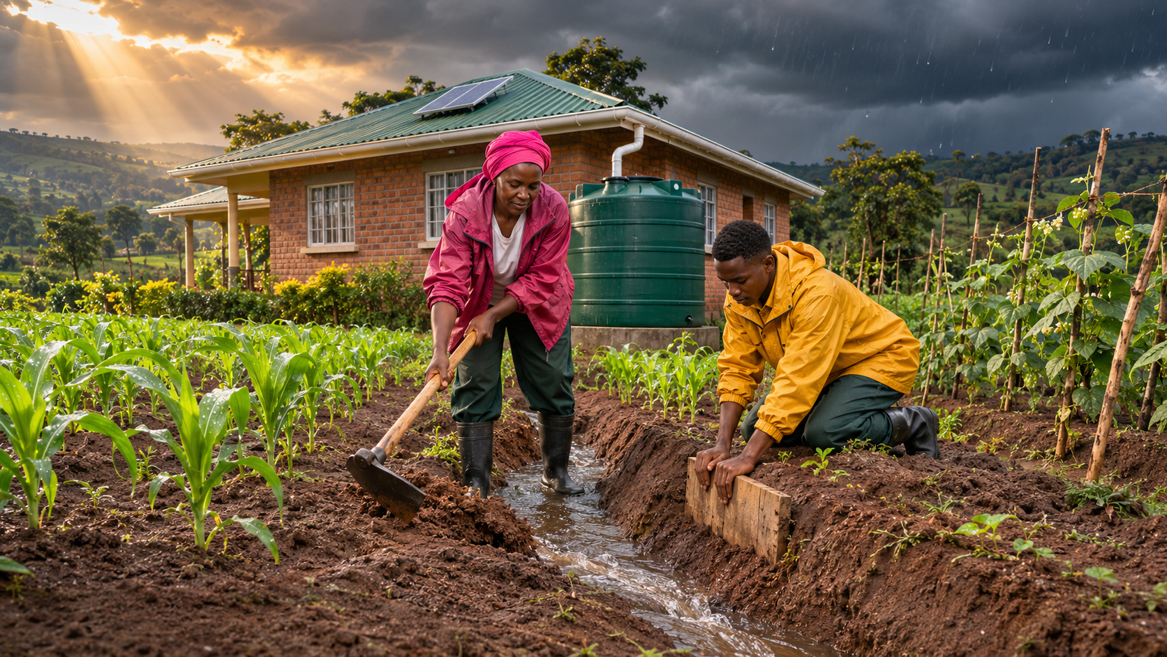
Move water, do not fight it. Clear drainage channels, dig cut-off drains on slopes and plant on raised beds or ridges in low fields that flood.
Catch the rain for later. Water pans, tanks and roof gutters filled now will help in the dry months that often follow a wet season.
Choose the right crops for the field. Avoid waterlogged ground for maize and beans. Short-season and flood-tolerant crops are safer bets on low land.
Vaccinate before the mosquitoes peak. Talk to a vet or county livestock officer about Rift Valley fever vaccination, and keep animals on higher ground at night.
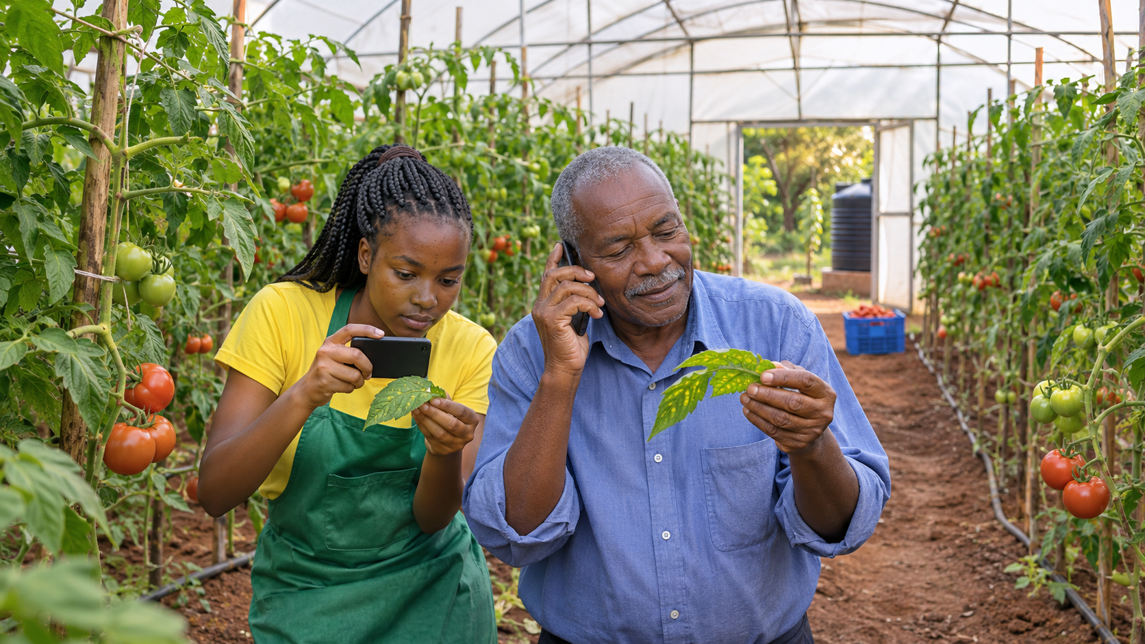
Watch for crop disease. Wet, warm weather favours late blight in potatoes and tomatoes and fungal rots in maize. Scout fields every week.
Dry and store grain properly. Damp grain grows mould and aflatoxin. Dry it well, store it off the floor and keep stores dry.
Protect the harvest route. If roads in your area washed out in 2023, agree on collection points with buyers or your cooperative now.
Plan your selling. If you have grain or livestock to sell, keep an eye on regional prices. A short harvest in the south could lift prices in the new year.
El Niño will pass, probably by the middle of 2027. The farms that come through it best will be the ones that treated the forecast as a planning tool. To learn more about managing water, soil and livestock health in a changing climate, explore the farmer courses on Eagmark Training.
This article draws on figures from World Bank. 2026. Building AI Readiness. Africa Economic Update (October 2026). Washington, DC: World Bank. License: CC BY 3.0 IGO.